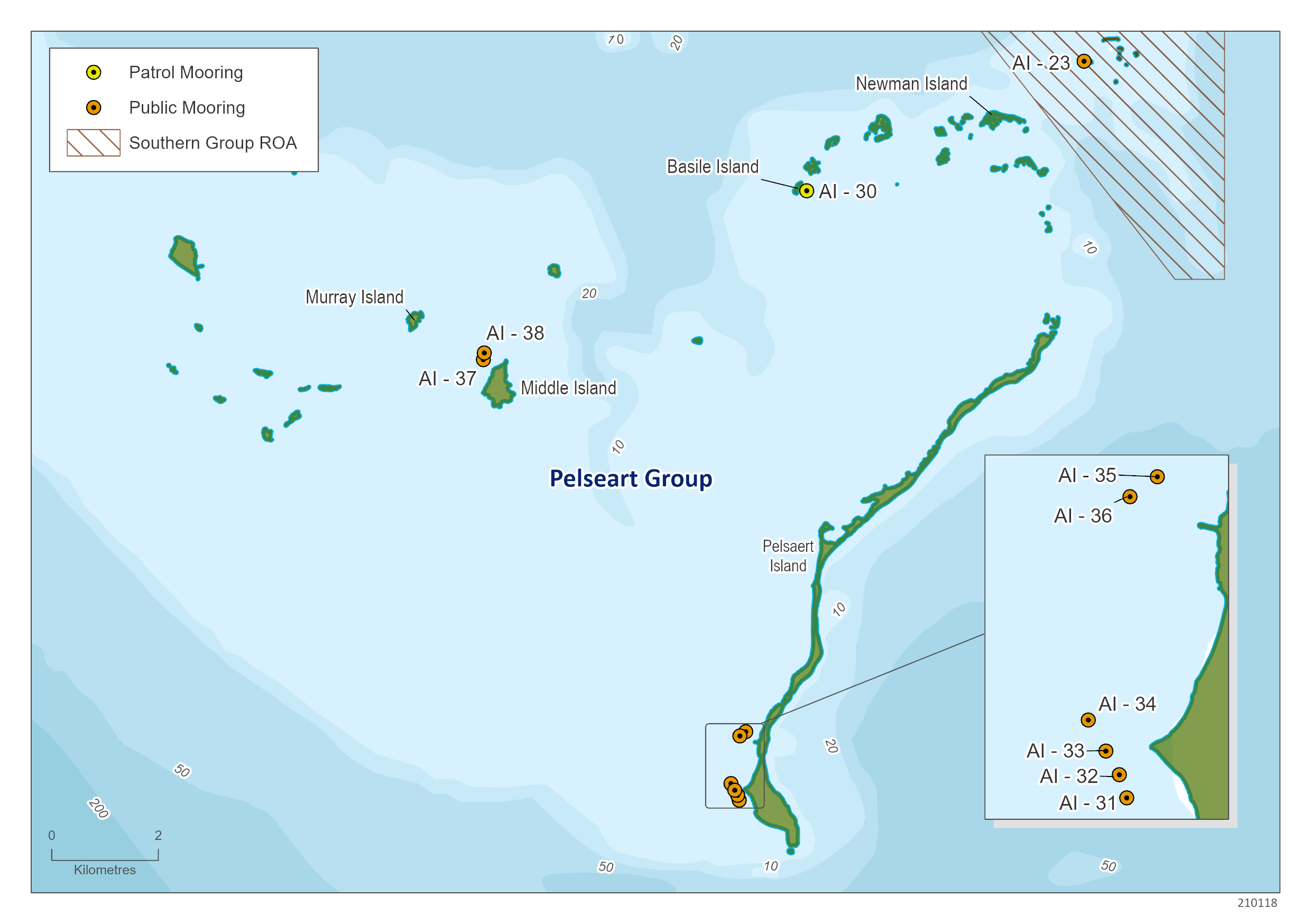
Public moorings are located within each of the island groups at the Abrolhos. See below for the mooring locations (DATUM GDA 94) - North to South.
| Location |
Mooring Number |
Latitude |
Longitude |
Depth (metres) |
| Anchorage |
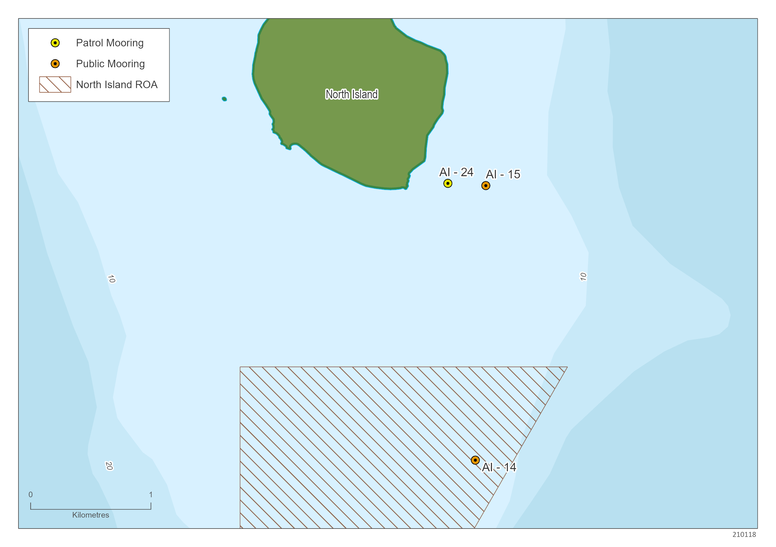
AI – 15 |
28°18.481'S |
113°36.354'E |
5 m |
| Location |
Mooring Number |
Latitude |
Longitude |
Depth (metres) |
| Turtle Bay |
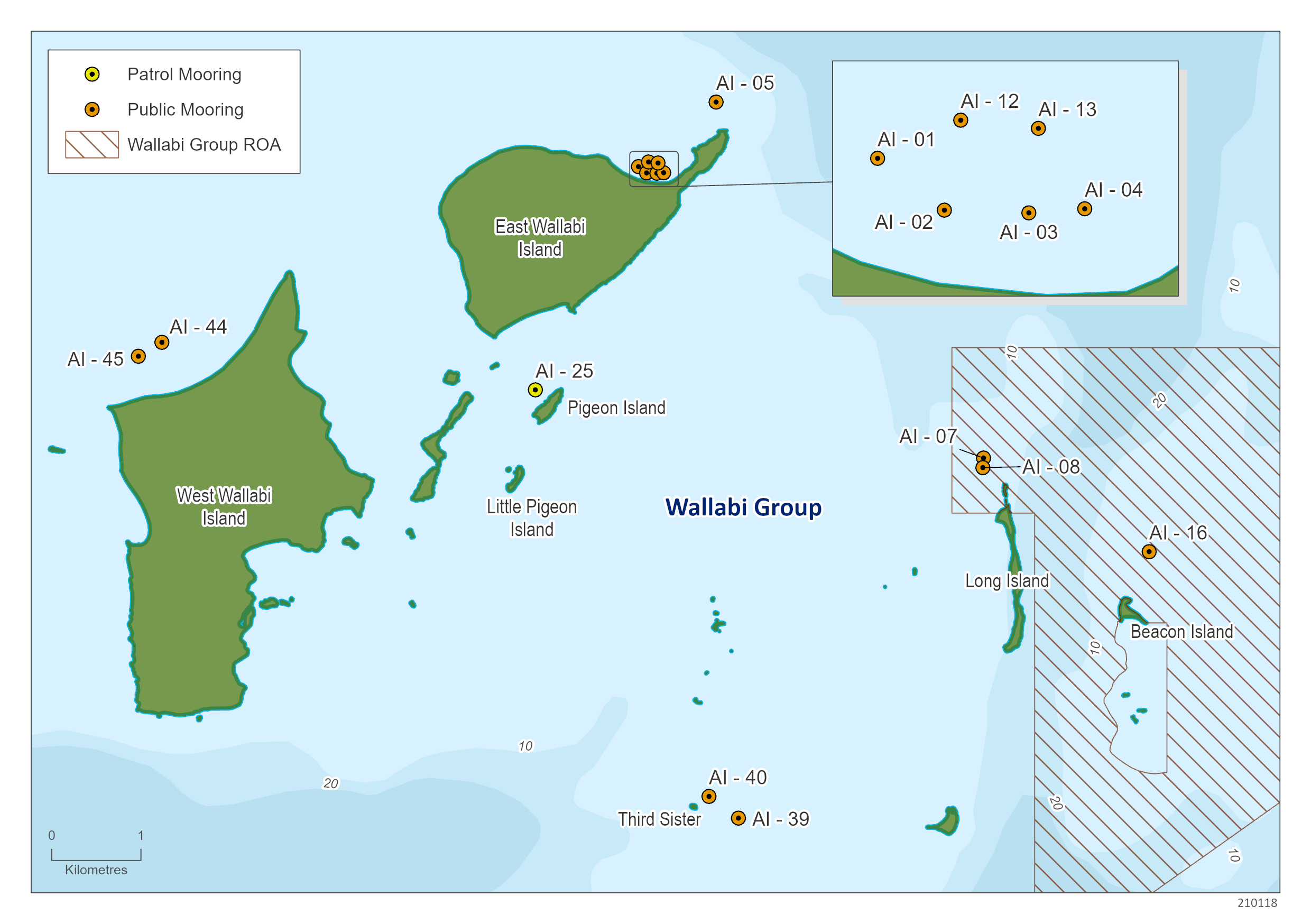
AI – 12
|
28°25.804'S |
113°44.253'E |
5 m |
| Turtle Bay |
AI – 13 |
28°25.810'S |
113°44.310'E |
4.5 m |
Turtle Bay
|
AI - 1 |
28°25.832'S |
113°44.192'E |
5 m |
| Turtle Bay |
AI – 2 |
28°25.870'S |
113°44.241'E |
4 m |
| Turtle Bay |
AI – 3 |
28°25.872'S |
113°44.303'E |
4 m |
| Turtle Bay |
AI – 4 |
28°25.869'S |
113°44.344'E |
4 m |
| West Wallabi Island |
AI - 44 |
28° 26.894'S |
113° 41.312'E |
4.8 m |
| West Wallabi Island |
AI - 45 |
28° 26.978'S |
113° 41.170'E |
3.6 m |
| Long Island |
AI – 7 |
28°27.593'S |
113°46.277'E |
6 m |
| Long Island |
AI – 8 |
28°27.651'S |
113°46.273'E |
5 m |
| Beacon Island |
AI – 16 |
28°28.159'S |
113°47.278'E |
6.5 m |
| Seven Sisters |
AI - 40 |
28° 29.638'S |
113° 44.618'E |
12 m |
| Seven Sisters |
AI - 39 |
28° 29.769'S |
113° 44.796'E |
11 m |
| Location |
Mooring Number |
Latitude |
Longitude |
Depth (metres) |
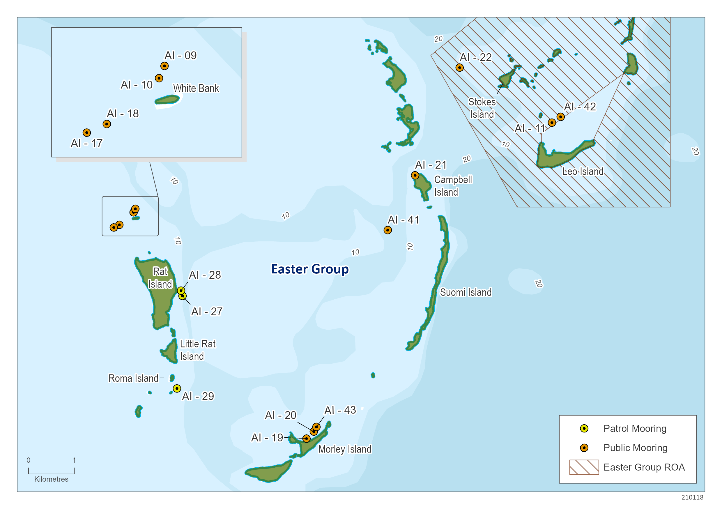
| Anemone Lump |
AI - 22 |
28°40.288'S
|
113°50.611'E |
5 m |
| Leo Island |
AI - 42 |
28° 40.864' S |
113° 51.797' E |
18.5 m |
| Leo Island |
AI – 11 |
28°40.932'S |
113°51.695'E |
7 m |
| Eagles Nest |
AI – 21 |
28°41.553'S |
113°50.086'E |
6.8 m |
| Roo-Tail Coral |
AI - 41 |
28° 42.198'S |
113° 49.765'E |
14 m |
| White Bank |
AI - 9 |
28° 41.947'S |
113° 46.795'E |
14 m |
| White Bank |
AI – 10 |
28° 41.987'S |
113° 46.777'E
|
14 m |
| White Bank |
AI – 18 |
28° 42.136'S |
113° 46.607'E |
7 m |
| White Bank |
AI – 17 |
28° 42.164'S |
113° 46.542'E |
7 m |
| Morley Island |
AI – 43 |
28° 44.511'S
|
113° 48.927'E
|
17.4 m |
| Morley Island |
AI – 20 |
28° 44.566'S
|
113° 48.896'E
|
10 m |
| Morley Island |
AI – 19 |
28° 44.646'S
|
113° 48.809'E
|
4 m |

| Location |
Mooring Number |
Latitude |
Longitude |
Depth (metres) |
| Coral Patches |
AI - 23 |
28°51.219'S
|
114°0.666'E |
16 m |
| Middle Island |
AI – 38 |
28° 54.170'S |
113° 54.598'E |
5.7 m |
| Middle Island |
AI – 37 |
28° 54.238'S |
113° 54.589'E |
5.3 m |
| Pelsaert Island |
AI – 35 |
28° 58.002'S |
113° 57.243'E |
13 m |
| Pelsaert Island |
AI – 36 |
28° 58.045'S |
113° 57.184'E |
14.8 m |
| Pelsaert Island |
AI – 34 |
28° 58.527'S |
113° 57.094'E |
3.4 m |
| Pelsaert Island |
AI – 33 |
28° 58.594'S |
113° 57.132'E |
3.8 m |
| Pelsaert Island |
AI – 32 |
28° 58.645'S |
113° 57.161'E |
5 m |
add map