Western Australia's Western Rock Lobster (Panulirus cygnus) Fishery has received international acknowledgement as one of the best managed and most sustainable in the world.
The Western Rock Lobster fishery is one of only a handful of fisheries in Australia where a long-term scientific program informs predicted catches up to four years in advance.
The program also provides estimates of the breeding stock levels, factoring in natural variations to the population, as it responds to both fishing activity and environmental conditions.
Catch predictions are informed by an extensive, year-round monitoring program estimating the abundance of post-larval stage lobsters (puerulus) settling on inshore reefs along the West Coast of Australia.
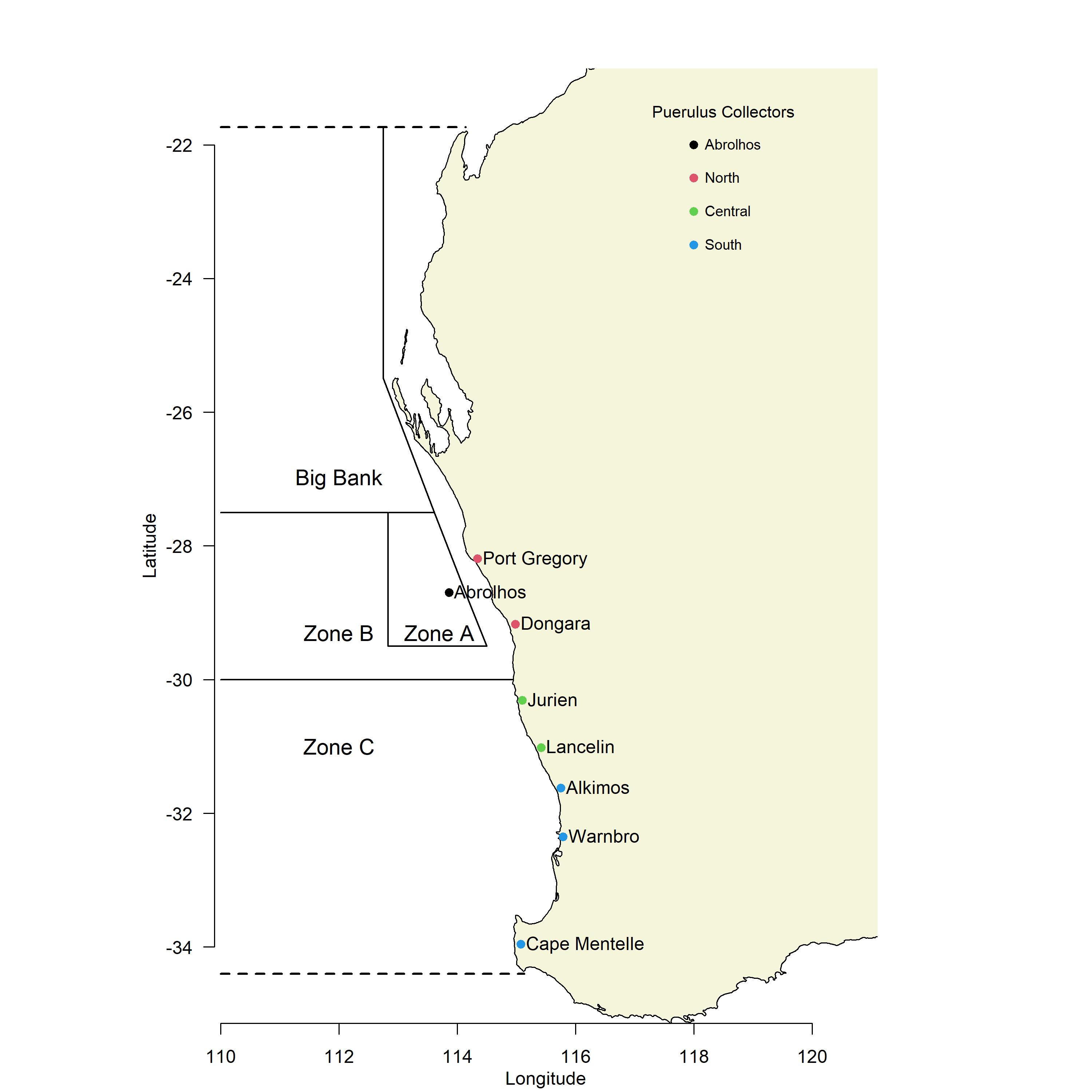
This monitoring program started in 1968 at Seven Mile Beach north of Dongara, and since then other sites have been progressively added so that now eight locations between Kalbarri and Cape Mentelle are sampled every month.
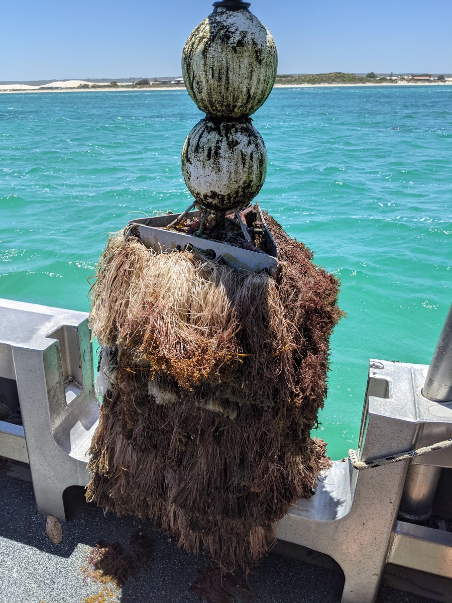
At each sampling site we have deployed either five or six (depending on localised space and habitat) puerulus collectors, which consist of three panels covered in fibre tassels, affixed to a stainless-steel frame floating on the surface.
The puerulus stage of Panulirus cygnus naturally settle onto seaweed floating around nearshore reefs, which they may be using to sneak past predators on their way to settling into crevices and holes within these reef systems. This behaviour is exploited by our collectors, which mimic floating seaweed.
Research has indicated that puerulus settle onto our collectors around the dark new-moon period, with most settlement occurring during the period of no moon and ceasing when moonlight intensity rises above 10% of full moonlight. Sampling during the full moon period ensures that the samples are representative of the previous month’s (dark-moon) settlement period. Each panel from each collector is shaken a prescribed number of times and any puerulus present are counted. For more information on puerulus collectors and the collection method visit  this site for published research.
Settlement index
For each site a monthly average is determined based on the total number of puerulus retrieved from each collector, averaged over all the collectors sampled in that month. Since puerulus numbers generally peak in Spring and are their lowest in Autumn, the settlement season is considered to start in May and end in the following April. At the end of the settlement season, in April each year, a seasonal average is determined, which is the sum of the monthly averages from May to April, inclusive. This seasonal average has consistently shown a strong correlation with the abundance of lobsters three to four years later.
Environmental factors, such as the strength of the Leeuwin Current, winter/spring westerly wind patterns, and water temperatures, play an important role in the survival and settlement of puerulus and thus the numbers that are found on our collectors.
About the figures
The graphs have recently been modified to an interactive format that allows users to choose which site they wish to see on the graphs and over what time-span they wish to see averages. These figures (Current data – November 2021) show the pre-2007 average (old long-term average; black dotted line), the 2007-present average (red line), and the current season’s puerulus settlement (blue line). On the monthly average figures, the vertical dotted lines represent the start and end of each settlement season (May and April).
https://lobsterapp.shinyapps.io/Display_Puerulus_Graphs/